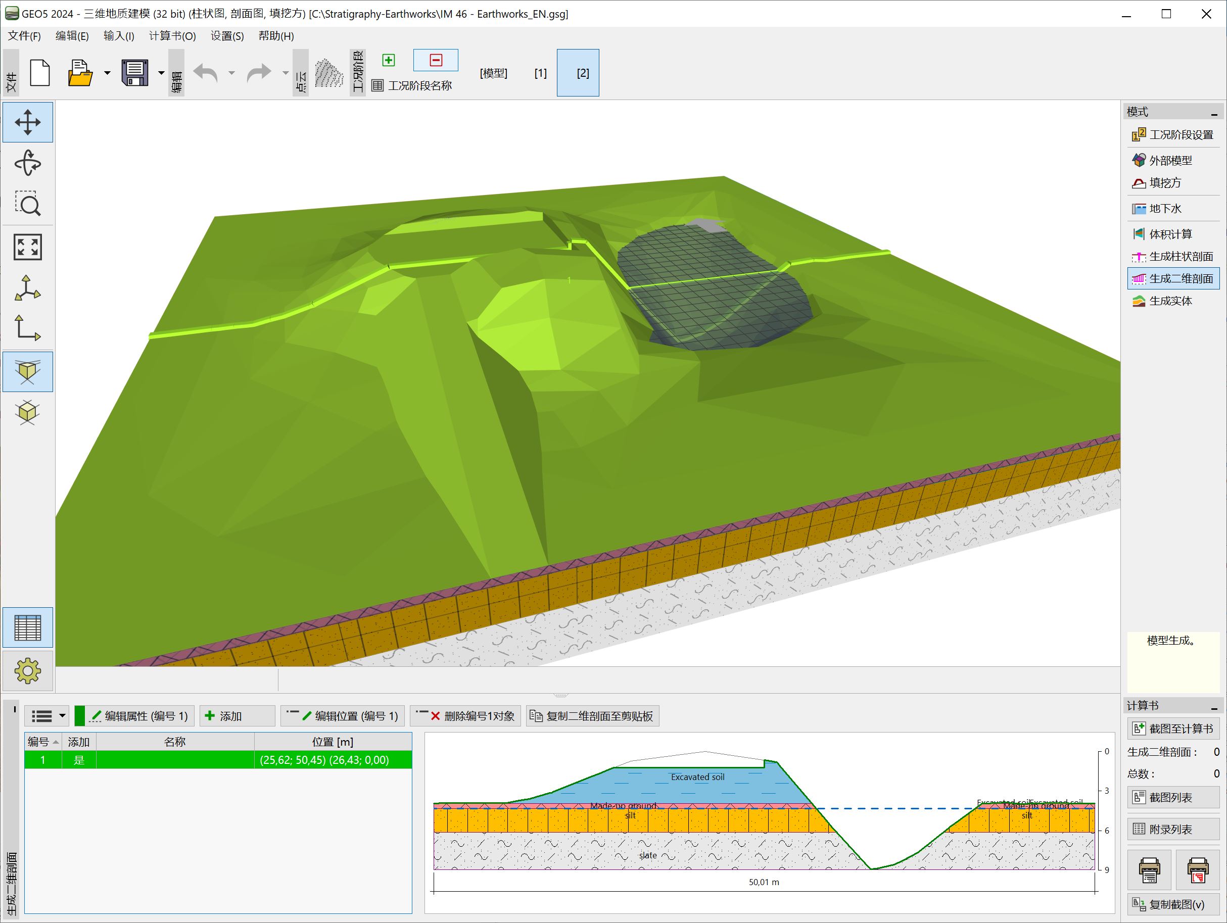
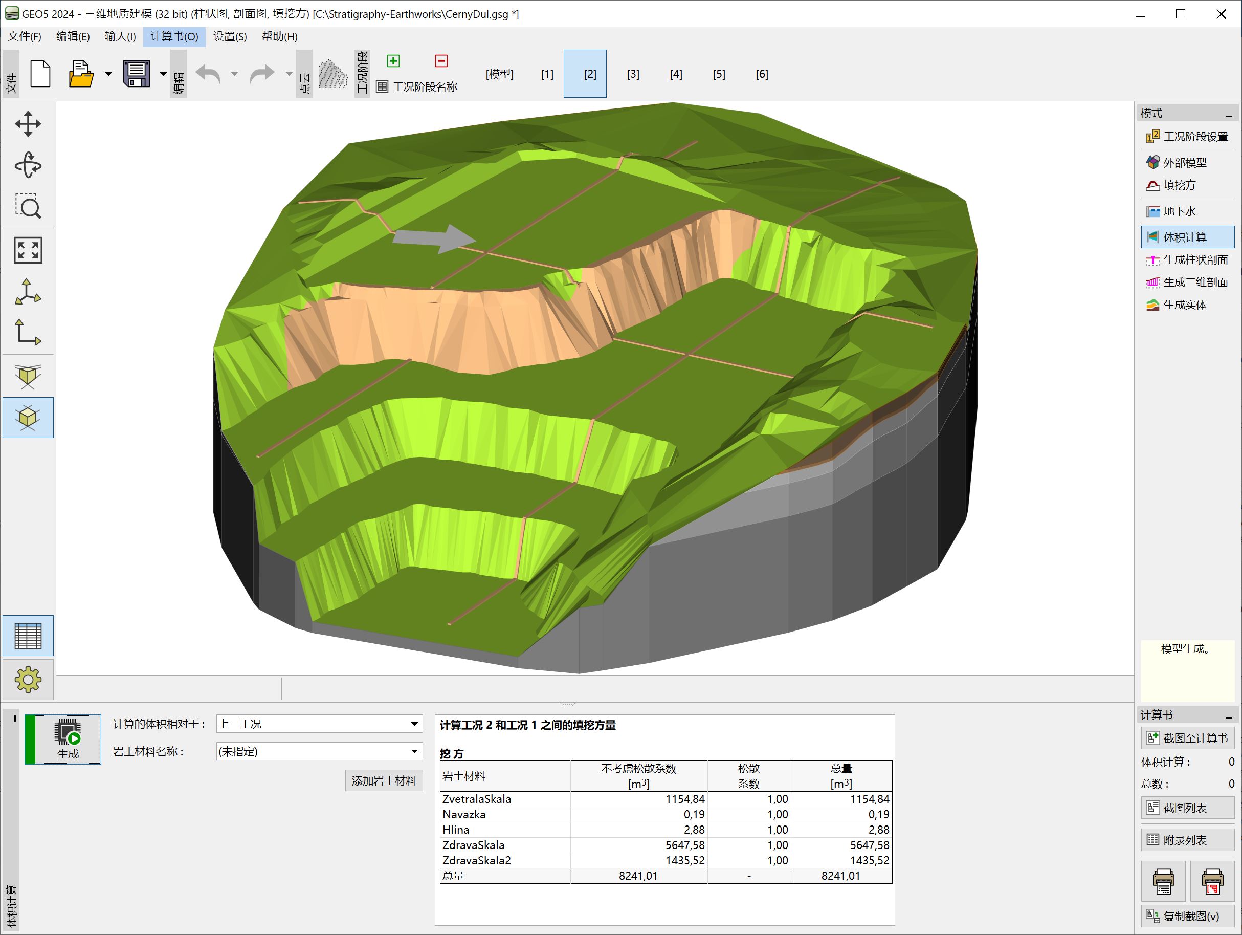
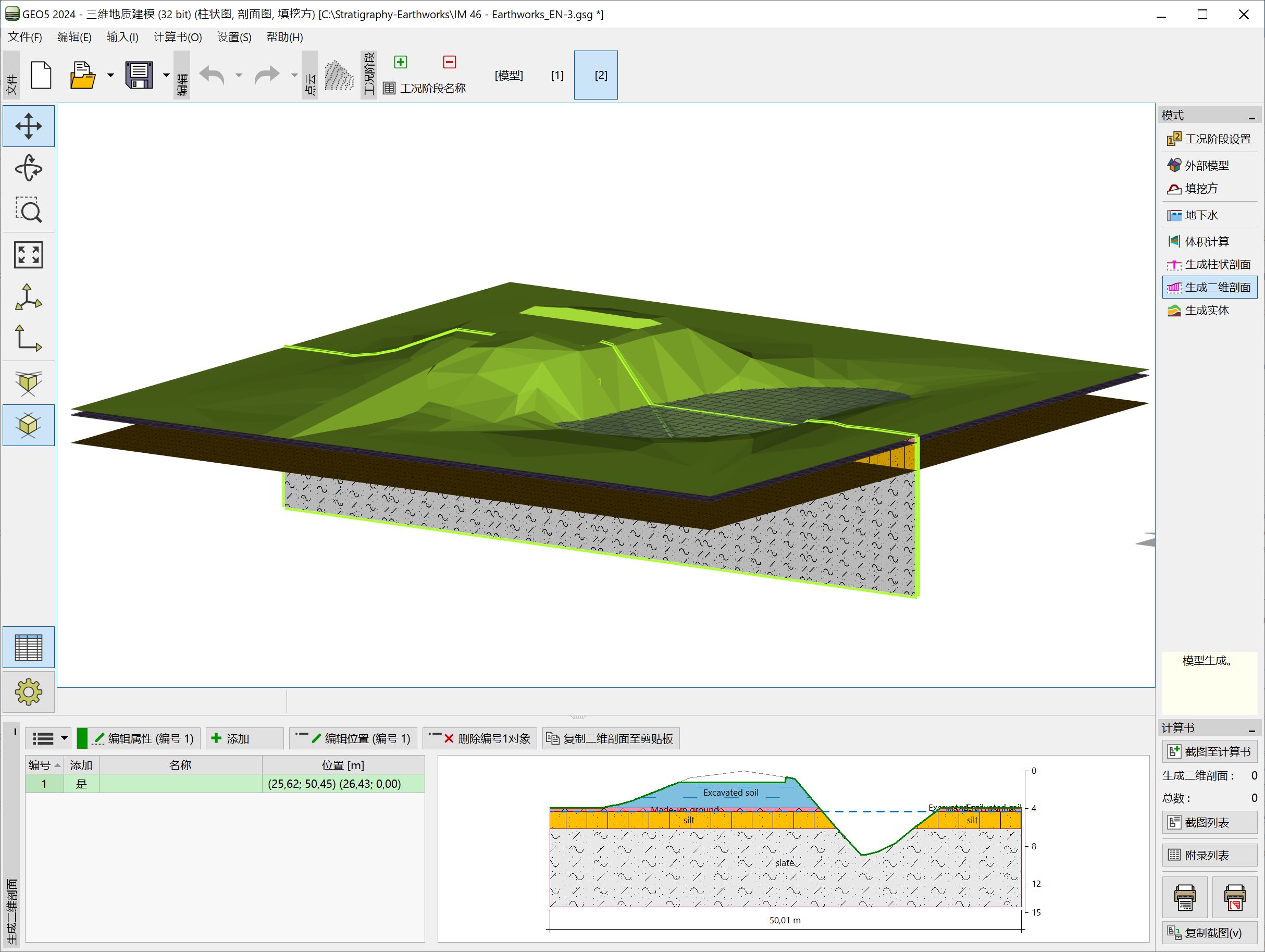
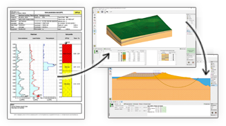
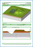
填挖方模块可以对基坑、道路、铁路、采石场、边坡进行建模,并计算土方量以及查看地形变化。也可以生成导入到 GEO5 其他模块的二维剖面图。填挖方模块是三维地质建模模块的一个扩展模块。
More Features
The module is not available separately. The Stratigraphy program is required.


The software in general is very good and ties in well with the way we do things here. From our review, the calculation results compares very well with our methods for both slope stability and settlement. The graphics and the ‘point-and-click’ data input are also very good and makes the program very easy to use.

It’s really great how easy the software is. I’m now doing the calculations so much faster and easier than doing it manually and most importantly, the technical customer service team are great and they respond instantly and professionally to any question or clarification. Thank you guys for being so awesome. High fives!

Great software....highly recommend.....always updating/improving and implementing feedback from users.